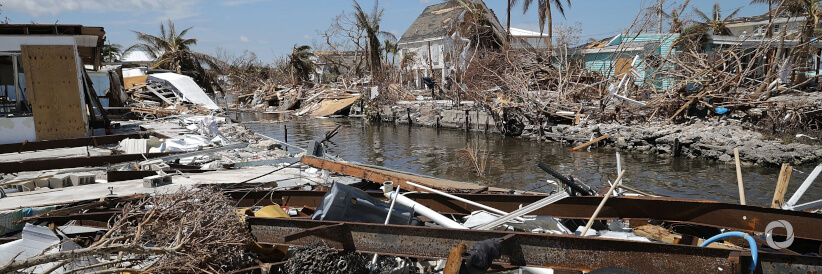
The ongoing La Niña event and above-average Atlantic Ocean temperatures have set the stage for an above-average hurricane season. This would make it the seventh consecutive year of above-average activity, according to an outlook from the US National Oceanic and Atmospheric Administration (NOAA).
Forecasters at NOAA’s Climate Prediction Center, a division of the National Weather Service, predict a 65% chance of an above-normal season, a 25% chance of a near-normal season, and a 10% chance of a below-normal season.
NOAA is forecasting a likely range of 14 to 21 named storms (winds of 39 mph (63 kmh) or higher), of which 6 to 10 could become hurricanes (winds of 74 mph/119 kmh or higher), including 3 to 6 major hurricanes (category 3, 4 or 5; with winds of 111 mph/179 kmh or higher). NOAA provides these ranges with 70% confidence. NOAA’s outlook is for overall seasonal activity and is not a landfall forecast. The hurricane season extends from June 1 to November 30.
In the North Atlantic, and northeastern Pacific basins, WMO’s Regional Specialized Meteorological Center Miami (the US National Hurricane Center) is responsible for tropical cyclone forecasting, including for marine-related hazards.
The hurricane seasons in 2020 and 2021 were exceptionally active and both exhausted the regular names from WMO’s rotating list. WMO maintains lists of names in order to communicate about hazards and to save lives.
Every year, there are on average 84 named tropical cyclones all over the world. Over the past 50 years, every single day, they have caused on average 43 deaths and US$ 78 million in losses and have also been responsible for one-third of both deaths and economic losses from weather-, climate- and water-related disasters, according to WMO statistics from 1970-2019. But the death toll has fallen dramatically thanks to improvements in forecasting, warning, and disaster risk reduction coordinated by WMO’s Tropical Cyclone Programme.
The Intergovernmental Panel on Climate Change’s Sixth Assessment Report projects that the global proportion of tropical cyclones that reach very intense (category 4-5) levels, along with their peak winds and rainfall rates, are expected to increase with climate warming. Sea level rise and coastal development have increased the risk and impact.
In view of the growing hazards, WMO is working to ensure there is universal access to early warnings and is seeking to strengthen impact-based forecasting.
Improved services
For the forthcoming season, NOAA has enhanced a number of products and services. They include::
- To improve the understanding and prediction of how hurricanes intensify, NOAA’s Atlantic Oceanographic and Meteorological Lab and Pacific Marine Environmental Lab will operate five Saildrone uncrewed surface vehicles during the peak of the 2022 hurricane season and coordinate for the first time with uncrewed ocean gliders, small aircraft drone systems, and NOAA Hurricane Hunter aircraft to measure the ocean, atmosphere, and areas where they meet.
- The Hurricane Weather Research and Forecast Modeling System and Hurricanes in a Multi-scale Ocean-coupled Non-hydrostatic model, which has shown significant skill improvements in terms of storm track and intensity forecasts, have been successfully transitioned to the newest version of the Weather and Climate Operational Supercomputing System, allowing for uninterrupted operational forecasts.

