
Add us as your preferred source on Google to see more of our content in Search.
 Add to Preferred Sources
Key reasons to read this article
- Discover what happens when humanitarian agencies lose sight of the very people they are trying to help.
- Find out how people can disappear from humanitarian response without ever leaving their homes.
- Understand why AI and satellite technology still cannot fill one crucial gap in humanitarian data.
- Uncover how the loss of evidence could become another reason to cut humanitarian aid.
Millions of people depend on humanitarian agencies to identify where food shortages are worsening and where assistance is urgently needed. But as funding cuts reduce the number of areas being monitored, some communities risk being left out of the picture.
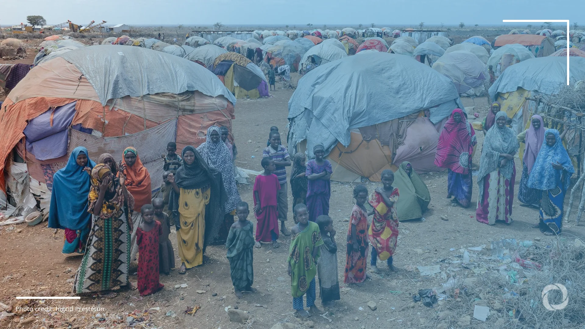
Somalia illustrates the dilemma. The latest Integrated Food Security Phase Classification (IPC) estimates that 5.4 million Somalis will face crisis-level food insecurity or worse between October and December 2026. Yet the projection draws on assessments covering just 35 of the country’s 107 livelihood zones, down from 73 a year earlier, according to the World Food Programme (WFP) and the International Food Policy Research Institute (IFPRI).
As almost 70% of the country’s territory is no longer being assessed, humanitarian agencies have less data about where hunger is worsening, how many people are affected and which communities need urgent assistance. The information gap is emerging against a backdrop of a decades-long armed conflict, bombings, targeted killings, injuries, and sexual violence. Meanwhile, 3.8 million Somalis have been forced from their homes by conflict, drought and floods, rendering monitoring even more complicated.
Funding cuts weaken humanitarian data collection
Somalia is one example of how shrinking assessment coverage is leaving humanitarian agencies with less reliable information about people’s needs. Behind these gaps are funding cuts that are forcing aid organizations to scale back the systems used to monitor crises and track affected populations.
When humanitarian assessments cover fewer areas, people living beyond the reach of data collection risk disappearing from the decisions that determine who receives assistance.
The International Organization for Migration (IOM), for instance, faces a US$30 million funding shortfall, which, it said, impacts the efficiency of its Displacement Tracking Matrix, the world’s largest system monitoring where displaced people move and what they need. Moreover, the agency laid off hundreds of staff and scaled back tracking operations in the conflict-stricken South Sudan, Ukraine, Somalia, the Central African Republic and the Democratic Republic of the Congo.
The decline is global. The 2026 Global Report on Food Crises covered 47 countries and territories, the fewest in a decade. In it, the UN Food and Agriculture Organization (FAO) and WFP say their main data collection dropped by 30% in 2025, mainly due to funding cuts.
A squeeze on both sides: less information, harder choices
The loss of information comes as humanitarian agencies are already struggling to decide who should receive increasingly limited assistance. The United Nations Office for the Coordination of Humanitarian Affairs (OCHA) estimates that 239 million people will need humanitarian assistance in 2026, but response plans target 135 million, with just 87 million prioritized.
Meanwhile, OCHA’s 2026 Centre for Humanitarian Data report has found that agencies are maintaining data collection in priority crises by conducting assessments less frequently, covering fewer areas and adopting cheaper methods.
Funding cuts are weakening the systems that help humanitarian agencies identify where people are, understand what they need and decide where limited resources should go.
The contradiction is stark. Agencies are being asked to make increasingly difficult decisions about who receives assistance while collecting less information about the people whose needs they must compare. As assessment coverage contracts, communities that are harder to reach risk becoming harder to include in funding appeals and resource allocation decisions.
How weaker evidence distorts decisions
One of the biggest risks is that agencies may recognize a crisis too late. Without current household, market, and livelihood information, forecasts of food insecurity become less reliable, and opportunities for anticipatory action, which delivers assistance before a crisis escalates, are harder to identify.
Jean-Martin Bauer, the WFP’s director of food security and nutrition analysis, and Steven Were Omamo of IFPRI warn that this makes early intervention more difficult and costly. When deterioration is detected only after households have exhausted their coping strategies, aid arrives later, when needs are more severe and responses more expensive.
Weaker information makes it harder to decide how assistance should be distributed. Bauer and Omamo warn that weaker information systems create a feedback loop in which emerging crises are harder to detect and resources are allocated with less credible evidence. The resulting risk is exclusion errors, in which people in need receive nothing, and inclusion errors, in which assistance reaches those less in need.
Displaced families can be forced to move repeatedly, but when tracking systems lose the capacity to follow them, their needs become difficult to identify.
Stale data creates a further risk. ALNAP’s 2026 State of the Humanitarian System report finds that outdated demographic data has led to underestimates of the number of people eligible for assistance. OCHA separately warns that humanitarian decisions are increasingly based on outdated, incomplete, or non-comparable evidence.
These failures are unevenly distributed. Displaced people, minority groups, pastoralist communities, and populations in remote or insecure areas are harder to reach and more likely to go undocumented when monitoring becomes less frequent or covers fewer locations. The evidence guiding decisions about limited assistance increasingly fails to account for those hardest to see.
Can artificial intelligence and satellite technology fill the gap?
Satellite imagery, artificial intelligence (AI), and predictive modeling are becoming a preferred response to costlier or dangerous field assessments. Satellites can track settlement expansion, damaged infrastructure, and changes in environmental conditions. AI models can analyze weather patterns, food prices, and displacement trends to flag emerging risks. Bauer and Omamo say such tools can help fill gaps and stretch scarce resources, but with “no ground data, there is no reliable model, no reliable AI”.
The UN Office for Disaster Risk Reduction’s 2022 Global Assessment report similarly emphasizes that satellite data alone is insufficient for understanding systemic risk, and that traditional surveys remain essential for capturing the social and structural vulnerabilities, such as inequality, adaptive capacity, and gender-based violence, that remote sensing cannot observe.
Representation is a further concern. Talip Kilic, who manages the World Bank’s Development Data Group survey unit, argues that predictive systems often lack “the representative human data layer” needed to understand how displaced people, subsistence farmers, and communities without reliable electricity or mobile access are coping. Without it, he warns, “we risk missing the people that are most often left out of digital data”.
Satellite images and AI can help identify emerging crises, but they cannot establish whether families have enough food, safe shelter or access to healthcare.
Models trained on unrepresentative data can also entrench existing inequalities and biases. Maria Haas of Maastricht University’s European Centre on Privacy and Cybersecurity, writing for the International Committee of the Red Cross, warned that AI trained on incomplete data “risk[s] reinforcing blind spots and overlooking those most at risk” and that “bias in, bias out” means visibility biases shaped by donor interests and media attention can be reproduced at scale.
Remote sensing and predictive tools can strengthen early warning and help direct scarce assessment resources, but their reliability depends on regular household surveys, market monitoring, and community-level reporting. Technology can extend humanitarian information systems. It cannot replace the evidence that makes them reliable.
What the data drought means for those who decide
Where assessments are cut unevenly, crises can no longer be ranked against one another, and that comparison is what donors rely on. Credible, timely needs data allow them to justify allocations and resist political pressure to favour visible or strategically important emergencies. The New Humanitarian has warned that disrupted data pipelines would leave donors without the evidence to justify funding decisions, producing “further cuts and misallocations“.
Data also has a protective function. When governments seek to deny or downplay crises, independent assessment is one of the few counterweights.
For agencies, the risk is institutional as well as operational. OCHA’s regional note warns that without urgent action, 2026 “will set a precedent for a low-evidence baseline, undermining the credibility and effectiveness of humanitarian response”.
As humanitarian data becomes less reliable, aid agencies find it harder to justify funding decisions, creating a cycle in which weaker evidence can lead to further cuts and misallocated assistance..
For local implementing partners, the damage compounds. OCHA reports that localization efforts will proceed “with absent adequate IM (information management) support“, weakening data timeliness, trustworthiness, and comparability, just as national NGOs are expected to assume more responsibility. Agencies are increasingly forced to rely on secondary or partner-led data, which is cheaper but often less representative and harder to compare across contexts.
The OCHA Centre for Humanitarian Data argues that data should be treated as “a core asset” and “a public good in service of saving lives”. The evidence supports that framing. Household surveys, market monitoring, displacement tracking, and the local enumerator networks behind them determine whethser scarce assistance reaches the people it is meant to serve. Each loss weakens targeting, and weaker targeting makes the case for funding harder to sustain, which is the pressure that forced the cuts in the first place.