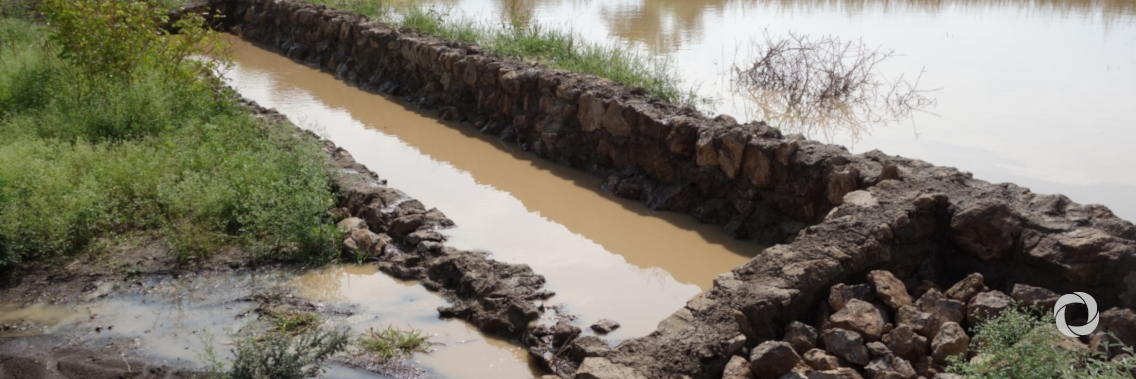
Climate change, droughts, and floods make arable farming virtually impossible in the Ethiopian lowlands. Weirs are used to collect the precious water and store it in the soil.
The impacts of climate change are particularly serious for developing countries. In the lowlands in north-eastern Ethiopia, temperatures of over 50 degrees Celsius and a lack of rainfall cause arid soils. Arable farming is only possible when there is precipitation in the highlands during the rainy season which then flows down to the lowlands. However, the water often flows uncontrolled through the dry valleys, creating flash floods that destroy plants and fields. This has dramatic consequences for the local population, with half the people in the region now dependent on food aid and temporary deliveries of drinking water.
The Deutsche Gesellschaft für Internationale Zusammenarbeit (GIZ) GmbH supports the local population in adapting to these conditions and reducing the effects of drought. On behalf of the German Development Ministry (BMZ), GIZ is promoting the construction of weirs at 16 pilot sites. The weirs are between 20 and 80 cm high and are built with natural stone. They control flash floods from the highlands and route some of the precious water to low-lying plains where it can be stored in the soil, making it possible to cultivate crops.
Construction of these weirs means that 3,800 hectares of land in the Ethiopian lowlands can now be used for cultivation, helping 50,000 people in the region to improve their nutrition. Village communities living in the project area have seen a real improvement in their livelihoods, food and nutrition security and access to water. The villagers now have access to water for themselves and their animals for six months of the year. Before the weirs were built, water was only available for two months every year.
GIZ staff are in regular contact with the local partners and communities to ensure that the weirs work in the entire pilot region. After every flood season, the weirs are inspected to assess if any damage has occurred. In addition, photographs are used to monitor any medium-term changes to the surface of the dry valleys.
Original source: GIZ
Published on 16 September 2019

